Posts

Showing posts from 2014

See you in 2015

Image
...for more culture and more geography... Here's a classic Ronald Lampitt for you...

John Hinde postcards...

Image
An interesting set of postcards from the great era of the card. My brother used to collect them and had hundreds of them. These days people tend to post pictures on social media instead, but we still try to send some to relatives when we go away. John Hinde was one of the big names in postcards for some time.

Coming in a month's time....

Image

"Woman reads map...."

Image
You've been watching the Detectorists I hope... Last night once again had Becky showing the power of a geography graduate....   Catch the series on iPlayer while you can...

Public Service Broadcasting

Image
Ready for this... a local concert at last...

The power of place

@GeoBlogs the spirit of place, the magic of geography, the uniqueness of landscapes, which must be explored with our techno kids. — Jeff Stanfield (@jeffstangeog) October 12, 2014

Remind me...

Not posted this for a while... an old classic

IKEA Ad

Geography Review magazine

Image
Geography Review magazine is one of the most useful resources that 6th form geographers (and GCSE students who want to push themselves) can have access to. It was started by my undergraduate tutor Tim Burt , his wife and colleagues back in 1986 , just after I finished my degree, and just before I started teaching in 1988. I was a subscriber from the start, and have used articles and ideas in my teaching ever since. I have paper copies of the first 15 volumes or so, and since then the school copies have taken over, and more recently, some electronic support materials to increase the usefulness of each issue. For example, check the extras for the September 2014 issue here.   Also the other recent issues. The magazine has now moved to Manchester , from Durham University, and has a new editorial board. There are the usual experienced authors writing for the magazine, and there's always something of interest in every issue. The first issue from the new team is now out. Details

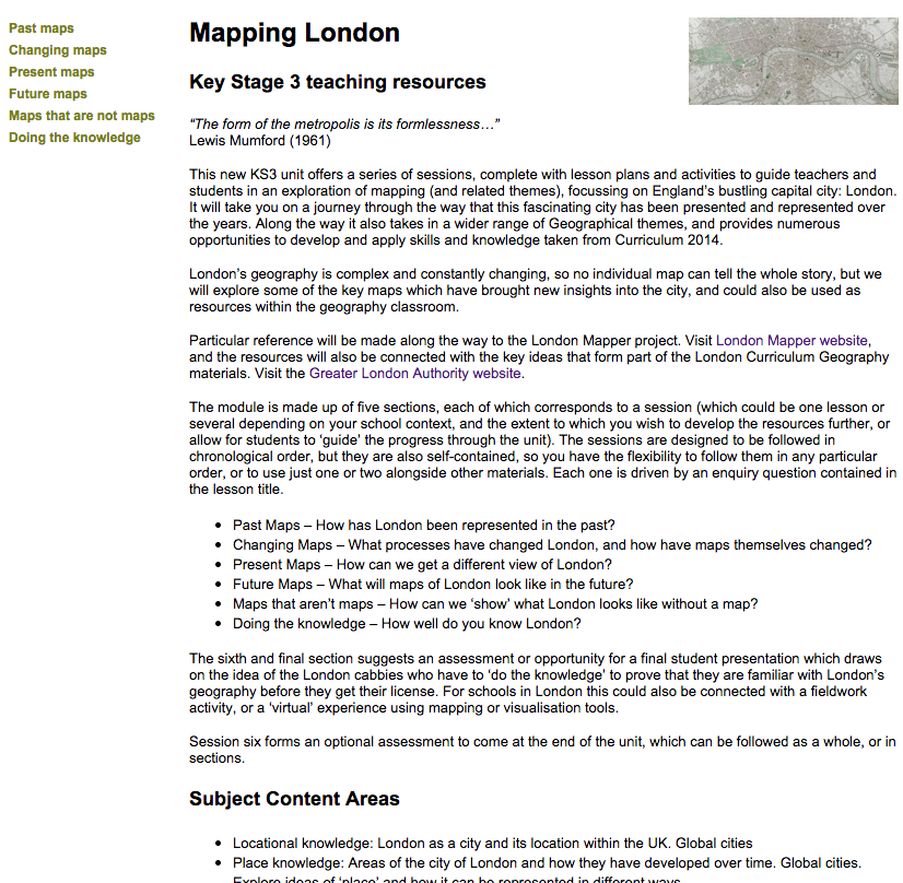
Mapping London

Image
There is a new area of the updated RGS-IBG website which you may not have seen. It is a project called Rediscovering London's Geography . It is described as follows: Rediscovering London’s Geography is a project funded by the GLA through the London Schools Excellence Fund.  It seeks to improve the quality of teaching and learning of geography in London’s schools, in addition to encouraging more pupils to study geography. Its scope encompasses connection across primary and secondary schools involving academy, free, maintained and independent schools. The project will: Create subject knowledge online resource units, including online activities and pupil assessments; focusing upon new curriculum subjects and examinations Improve subject knowledge via free CPD and training events in teacher networks across London and provide continuity to support the upcoming curriculum changes Engage pupils via Geography Ambassador presentations (by London undergraduates) and Going Places w

50 states of Lego

Image
Lego has grown in popularity massively over the last few years, and there have been lots of creative projects that have made use of it. These include the Follow the Things lego recreations , which featured in the Ideas Zone at the recent GA Conference. The BRICK FANTASTIC website has a new project which is a representation of the 50 states of the USA, and also a set of images of CANADA too. And finally, I'll be going to the Bricks 2014 show at the ExCeL in November this year. Any other Lego related projects I should be featuring here ?

Continents Drift

New on Spotify...

Exploring the culture of the Scottish Highlands

Image
In 1844, Hugh Miller : a geologist and preacher (amongst many other skills and abilities) embarked on a voyage through some of the islands of the Hebrides.  He was a self-taught geologist, writer and editor of a key Edinburgh newspaper in the lead up to the tectonic changes in the Scottish church that culminated in the Disruption of 1843. Miller was one of Scotland’s outstanding geologists, one of the first of many Scottish ‘citizen scientists’ and stands beside the greats of Hutton, Lyell and Murchison. The Cruise of the Betsey took place the year after the Disruption, when 450 ministers broke away from the Established Church. Miller joined his boyhood friend the Rev Swanson, a keen supporter of the Disruption, who had been removed from his Small Isles parish and his manse on Eigg. Swanson used the Betsey as his ‘floating manse’ so that he was still able to serve his parishioners. The cruise was to visit Tobermory, Eigg, Rum, Glenelg and Isle Ornsay on Skye. Miller’s accounts re

Another for Mike Oldfield fans

Image
This time, it's the man himself. He has been remixing his albums and releasing them with extra tracks and other bits, and as part of the process, he released this short mix of part of one of his classic songs: 'The Lake' , from 1984's Discovery album. One of the memories I have from that time is listening to this track while sitting by an amazing lake in the fjords of Norway as a student. This mix reveals extra layers of beauty which aren't obvious in the final piece, which is a little full of Fairlight...

Our Geography defines us...

An interesting read in the LA Times, about how our geography may shape the opinions we have on certain things... "accidents of geography — in this case whether someone was born in a hilly or a flat region — can alter how a person thinks in all sorts of unexpected realms."

One for Mike Oldfield fans...

Image
Enjoying this new Robert Reed album...

Global village Scheme of Work

Image
I've been working on an online course that is going to be hosted on the Geographical Association 's website. It will be arriving on the website for the Autumn term, as Curriculum 2014 gets underway, and is going to be suitable for KS3 Geography. It is linked to the GA's involvement as a major partner in the Global Learning Programme. A number of courses and conferences have taken place this year as part of the Global Learning Programme's first year, although not as many as expected. I attended an event for Primary colleagues at the Oval earlier this month. My course explores some ideas for using web tools to develop global stories. One element of the course is a draft outline scheme of work. This draft outline for a Global Learning scheme of work , which will be fleshed out over the next few months, has been put onto Google Drive , so that it is collaborative in nature. If you'd like to get involved in the development of the scheme, please get in touch. I&

First Class Fish

Image
A new set of stamps from the Royal Mail features 10 fish, to show some sustainable species, and others that are threatened. Lovely illustrations. Did any of these species feature in your menu that was good for the planet ? Which fish species would you put on stamps if you could choose...

IB course with Richard Allaway

Image
A rare chance to work with Richard Allaway of Geography all the Way fame ,  on an IB Geography course in the UK takes place in 3 weeks time. The course is held at Heathrow Airport , and is on a Saturday so no cover needed (probably) Details and booking information here.

GA Worldwise Week

Image
Worldwise Week (formerly Geography Awareness Week , is organised by the Geographical Association. This year's resource pack is available , and would provide some good ideas for those wanting to continue the theme of this year's conference 'Crossing Boundaries' with some end-of-the-school-year extension work. Head to the GA website to download the pack and join in from the 23rd to the 27th of June.

LondonMapper

Image
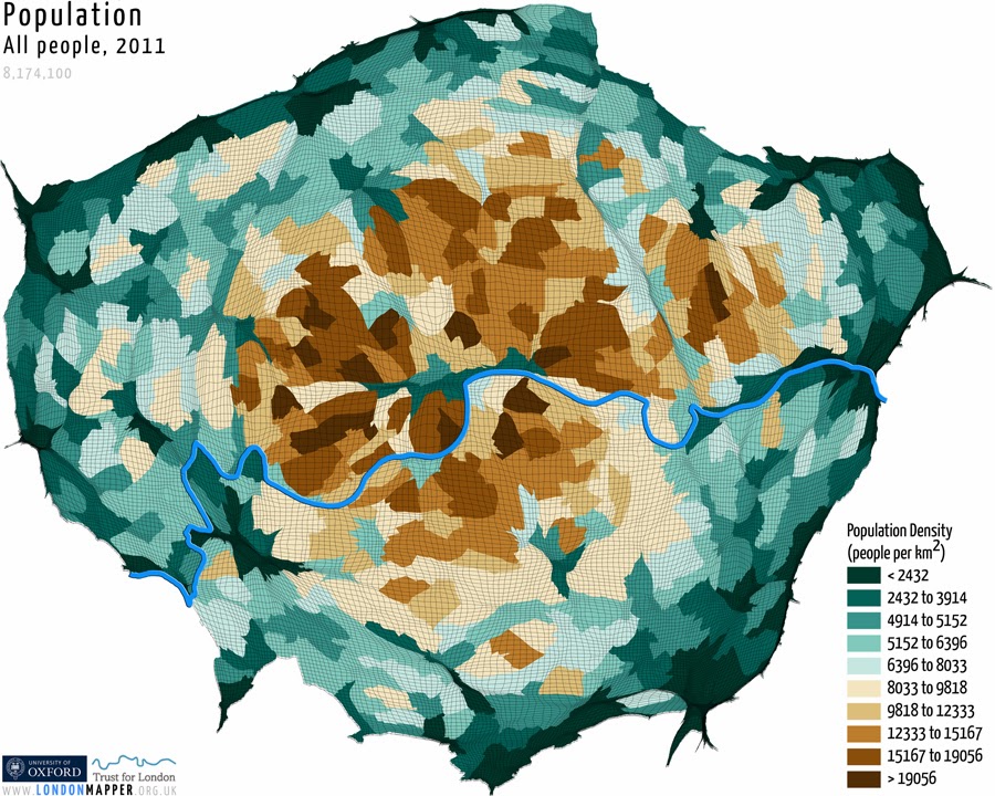
“Our aim is to provide unbiased information about London's social, environmental and economic issues. “These maps are like fancy pie charts, and if something is twice the size of something else it is obvious. We just want to spark a debate about the differences in one big city.” Professor Danny Dorling London called me on Thursday this week, and I went down to the RGS to meet with Ben Hennig. Ben and I are working on some educational materials for a project called LondonMapper - a website which officially launched today , funded by the Trust for London. The educational materials are being funded by an Innovative Geography Teaching grant that we have been awarded by the Royal Geographical Society. Ben's maps will be familiar to many from his work on WorldMapper with Danny Dorling and others from Sheffield University. Ben now works at the University of Oxford , still with Danny Dorling , and LondonMapper is one of several exciting projects that he is workin

Teaching Geography in a Digital World

Image
I had a sneak preview of Paul Turner's new iBook a few days ago, and it's now out, and available on iTunes at 'my favourite price'. This is a really nice summary of some of the best tools out there for teachers wanting to find out about technology that can help. I particularly like p.54 :) Well done Mr. Turner !

Now listening...

GA Conference 2014

Image
I've recently returned from a very successful GA Conference 2014 at the University of Surrey in Guildford, where I was involved in a number of workshops and meetings, which included a project called I-USE. Want to know more about I-USE ? Here's the project leaflet. i Use Leaflet Here's a nice shot of me in action too. Image copyright: Rose Ledgard / Geographical Association For more posts on the conference, head over to LIVING GEOGRAPHY where there are over 20 posts describing the event...

Do it for Denmark

An interesting campaign to tackle low birth rates in Denmark, which could well have been an April Fool's joke given the date... Called Do it for Denmark , it is being organised by a travel company in Denmark, and those who participate in the scheme have a chance to earn prizes if they can prove that they conceived a baby while on holiday with the firm. An interesting one for pro-natal population policies.

Greater London National Park

Image
A campaign is launched today which suggests an obvious move forward for our capital city: a designation as the country's newest National Park. We see no reason why London shouldn't join the Peak District, Snowdonia and the Norfolk Broads as having a designation as a National Park. The city has a breadth of habitats, and a diversity of wildlife that rival some of the existing parks. Check out the new WEBSITE to find out more. From the press release... The Greater London National Park* was launched today, celebrating the importance and diversity of London’s urban habitat. It may sound like an April fools joke, but it is not. It is only a “notional park” for now, but geographer Daniel Raven-Ellison is calling for the public to back the idea.“There is this idea that a National Park has to be remote and rural, but cities are incredibly important habitats too. An amazing 13,000 species of wildlife can be found in London’s open spaces which together make up 60% of t

Cultural Geography

Music for Earth Hour...

Extreme Environments e-book

Image
One of the things about being a prolific blogger is that things you write disappear off the main section of the blog quite quickly. I thought it was worth reminding you of something that I created a while back with the guy on the left here... A couple of years ago, Richard Allaway and I created an eBook on Extreme Environments. It is perfect for revision, and as we come closer to REVISION SEASON you may want to download it, as thousands of other people have already done. Now available in over 50 countries...

DISTANCE... we've come a long way...

Image
Distance stands for: Demonstrating the Internet of School Things: a National collaborative experience It's a project that I've been involved with along with a group of partners including INTEL, Sciencescope, CASA at UCL and the Open University. Helen and Tom from Explorer HQ have worked with me to produce some exciting ideas, supported by Mark, Dan, Paul and other colleagues from Explorer HQ on the technical side. We've been working to create educational materials for the schools involved in the Pilot, and ultimately schools all over the country. Click the Resources tab on the website, and you will find that you can see some of these... They would be useful to adapt even without access to the kit that the schools had. The website has developed tremendously since the start of the project... Follow Apps > Dashboard to see some of the live data feeds from the project.

Museum of British Folklore

Image
Reclaim the Forgotten Cherish the Neglected Treasure the Abandoned Encourage the Overlooked Adore the Unfashionable Re-invent the Unwanted Champion the Unloved Value the Rejected If this museum gets the go-ahead I'd be pleased to work as the Education Officer :) Museum of British Folklore from Tom Chick on Vimeo .

Innovative Geography Teaching Grants

Image
Delighted to say that I've been awarded one of just two of these awards handed out this year, given out by the Royal Geographical Society , to work on a collaboration jointly with  Dr. Benjamin Hennig from the University of Oxford on a project related to the Census of 2011. Ben is the genius who created the Worldmapper cartograms , and creates maps at Views of the World . He is now working at one of the finest Geography departments in the world, and it is a real privilege to get the chance to work with him. Our project is called  LondonMapper: exploring a World city through Census Data The Census 2011 produced billions of pieces of data, and by focussing on London past, present and future we will explore ideas related to London and its place in the world, and guide students on an exploration through the Census data and present them with some decisions that need to be made, which will shape London's future... Our work will connect with, and expand on the

Sailing in the wake of Hugh Miller

Image
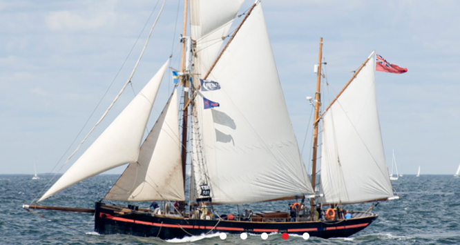
I've been reading quite a bit about a man called Hugh Miller in the last few weeks. He was a geologist and storyteller and had a fascinating life. Now you have a chance to sail through the Scottish Highlands on a voyage of discovery... The voyage is being organised by the Royal Scottish Geographical Society . The Geological Societies of Glasgow and Edinburgh are offering unique opportunity for young Earth scientists to follow the journey of Hugh Miller in "The Cruise of the Betsey". On 6 September 2014 Leader, a wonderful old Brixham Trawler built in 1892 ( www.trinitysailing.org/vessels/leader/ ), will set sail from Oban heading north for the Small Isles in a one-week voyage in homage to Hugh Miller and his Hebridean tours, descri bed in his classic book "The Cruise of the Betsey". The boat sleeps 19 people including 4 crew members, and will be filled with an inter-generational mix of geologists, geographers, artists, writers, ecologists, storytelle

Now listening...

New book published...

Image
Author copies of my new book for Collins have just arrived. Aimed at KS2/3 boys to get them reading, but also readable by all age groups and girls too...

Winter is coming...

Image
I'm about to head into a catch-up of the first three seasons of Game of Thrones , as the 4th season starts on Sky Atlantic. I don't have Sky, so this is my option for catching up with a lot of my colleagues... I've got a large poster map for my classroom wall, and a proposed unit on mapping of fictional landscapes, which will also form part of my presentation at the SAGT conference later in the year. There's also been a rise in tourism in Iceland and Northern Ireland: two of the key locations where the series is made. (Thanks to Rebekah Chew for the tipoff here) Iceland's tourist board says it's seen an increase in the number of people wanting to go on tours of locations where the show was shot. While, the film industry in Northern Ireland says it's helped increase employment in the area. But it's also helped spread the country's cinematic reputation around the world. Meanwhile I've got the first book on my Kindle, and am looking