Posts

Showing posts from 2019

Climate and Nature Emergencies Poll

If you teach, or parent young people - or you are one yourself, please fill in this survey - the more respondents the better. Thanks in advance. We have a new  Geographers for Life @Geo4Life Twitter feed too, where we will be releasing the results of our work. Loading…

New Poetry prize announced by Simon Armitage

Image
"I’ve always written poems about the area where I live, and my interests in things like the Antarctic and the Arctic and geography generally, all those subject matters are shaded now by the environmental situation."  Simon Armitage is a geographer, and the Poet Laureate. He grew up near Huddersfield, where I studied for my degree. His job carries a salary of £5000, and he has announced a new Poetry prize called the Laurel Prize for works on the theme of the environment and climate change. He has a lot of geographical credentials. He produced an excellent book around a visit to Iceland with Glyn Maxwell, following an early journey by W H Auden. He created some excellent radio programmes with a geographical theme, including one on the volcanic island of Surtsey His book 'All Points North' explored conceptions of the north. He has produced two books describing long distance footpaths and his experiences of the Pennine Way and the SW Coastal Path. He rece

New emojis for Africa

Image
An interesting Guardian article on a new set of emojis which has been produced for use in Africa. Alternative representations of life on the continent. For example, the standard food emojis don't feature African dishes. Images were shared on Instagram. These haven't been sanctioned as 'official' emojis but are available to download for use in apps such as WhatsApp when people communicate with each other. It also references Emojination , which has helped to get new emojis such as the hijab approved and added to the list preloaded onto iPhones and similar devices.

TV and Film Map

Image
I have all the maps which have been made by this company. They work closely with the Ordnance Survey. Their new map shows the location of Film and TV locations in the UK, along with other details of specific places. There are the locations of cinemas and other film related places as well. I'm just back from the SAGT conference, of which more to come, and I've previously done a session on the use of the Scottish landscape by Pixar when they made the film 'Brave'. Another series made in the area around Stirling is Outlander, and I noticed quite a few souvenirs related to that area in the visitor centres that I went to. A good Christmas gift for the geographer in your life.

The Lighthouse

Image
Over to Cambridge last night to watch this movie as part of the Cambridge Film Festival . It's a powerful vision of the descent into madness of two lighthouse keepers who find themselves staying beyond their allotted time: "to 4 weeks". The sound design and visuals are fantastic, and black and white is of course the best format for this sort of psychodrama. There are many themes explored with nods to Melville, The Ancient Mariner, mermaids and Prometheus and the theft of fire. It's also very much about creating and then slowly dismantling a 'place': the rock containing the island, some buildings which need constant maintenance, a large coal pile, some buried whisky and a very persistent seagull. Catch this when it comes out in the New Year and go for a deep dive which is actually worth it...

Surrey Geography Network Meetings

For those who are in Surre y or within easy reach, Brendan Conway has shared details of what looks like a very useful series of events in the next few months, and into 2020 . As you can see, there are some excellent speakers including the 'mighty' Simon Oakes and the GA's very own Alan Kinder. Details for booking are at the bottom of the blogpost. Surrey Geography Network meetings 2019-20 These are designed to help you to address current issues whilst at the same time networking with other geography leaders / teachers. The meetings will take place at Notre Dame School KT11 1HA from 1.30 to 4.30. The dates, speakers and their topics are as follows​: Tuesday 19th November: Enabling Data Skills in the Geography Curriculum, Dr Simon Oakes - former chief examiner, author and education consultant The session will present some excellent ideas for embedding data skills into Geography lessons. It will draw on Simon's Royal Geographical Society funded project work

Carbon City Zero Game

Image
Carbon City Zero is a new Kickstarter project which is developed by the people behind 10:10 Climate Action. It's a card game which explores the idea of carbon reduction. Here's the description. As a newly appointed city mayor you have been tasked with creating a carbon neutral city. It sounds easy, but you'll soon discover that your carbon budgets are hard to balance. Can you hit the zero carbon target before your rivals? The race to become the first zero carbon city is on... Carbon City Zero is a deck-building game for 2-4 players, in which players develop a sustainable city by building factories, managing people, lobbying government ministers, and raising public awareness. Each player starts with an identical Draw Deck (and a Carbon Level of 40), buying additional cards from a shared Marketplace to create a more sustainable city. Balancing the need to generate income with reducing carbon, players can follow numerous paths to victory, creating synergies between Gov

9/1 - Disaster Prevention Day

Image
The 1st of September is Disaster Prevention Day in Japan. It commemorates the Great Kanto earthquake that took place on that date in 1923 9/1 is Bosai ( #DisasterPrevention ) Day--visit the #BosaiDiversity site and better prepare yourself by discovering the many unique emergency needs of a diverse society. https://t.co/EMUl9rpaLi #ResilientJapan #LandOfDiversity pic.twitter.com/qCqymatg2C — The Gov't of Japan (@JapanGov) September 1, 2019 I've blogged previously about my Tokyo Bosai book, which was handed out to all households in the city. One of them decided to sell theirs on eBay. Check out the Bosai Diversity website  for a video and a set of cards of items which would be of particular value to particular people.  Click on the cards and tags and assemble your own kit , and recognise the different needs should a disaster arise. You can also share the kit you create with others... Looking to see if I can find the cards as a PDF download rather than

Norfolk - flat?

Image
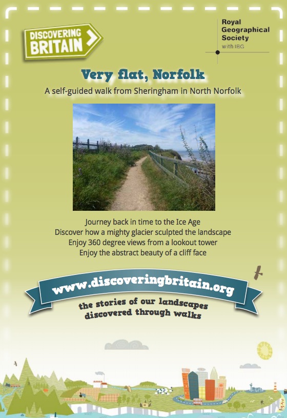
There are a few quotes that are associated with Norfolk , the county where I have now lived for more than half my life, and one of them is from a character called Amanda in the Noel Coward play 'Private Lives' from 1930, who says it is "very flat". Anyone who has cycled through Norfolk can testify that it is far from flat. Back in 2011, I was the President of the Norfolk Geographical Association , and for my presidential talk (which was also used for after dinner speeches) I created a talk exploring the sense of place that Norfolk has and explored what it means to different people. Very flat, Norfolk from GeoBlogs Interestingly, the Royal Geographical Society's Discovering Britain project (which has created walks with accompanying information for many locations around the country) have a walk based around Sheringham which takes that very name: Very flat, Norfolk. The walk was written by Daniel Evans , a Gap Year scholar of the Royal Geographic

Tokyo - planning for disaster

Image
A nice piece on Atlas Obscura. It describes a daily ritual which can be observed (or rather, heard) across Japan, at or around 5pm. It's the  shichouson bousai gyousei musen housou It’s known as the ‘5pm Chime’ (五時のチャイム) or, more officially (and tellingly), the ‘Municipal Disaster Management Radio Communication Network’ (市町村防災行政無線). That should give you some clue as to what it is for, and why you’ve probably never really understood it. After all, if all you’ve ever heard is eerie chimes or music at dusk, that likely means you’ve not experienced any major disasters (a good thing!) Officially then, the speaker network is part of a nationwide system set up around most villages, towns and cities to warn residents in the case of emergency – especially disaster warnings for tsunamis and informational broadcasts in response to earthquakes. Some systems are also set up to broadcast announcements of severe weather, fire, suspicious persons, dangerous wildlife or simply just publ

Ely

Image
Ely featured on this Open Country broadcast recently. Thanks to Helen Young for the tipoff. Earlier this year, Helen Mark visited the Isle of Eels in the heart of the Cambridgeshire Fens for its annual eel day festival. She joins the parade of eels through the streets and takes part in the World Eel Throwing Competition (which thankfully involves no real eels). She also learns about the life cycle of the eel and discovers how this extraordinary fish is intimately bound up with the history and culture of Ely. 

UN CC Accreditation - put your school on the map

Image
There seems to be a growing consensus now about the importance of teaching climate change in schools. And from my personal perspective, and Steve Brace of the RGS agrees , it's perhaps the geographers who are best placed to do that within the curriculum. However, all curriculum subjects could bring their own perspectives to the issue: the scientists exploring the atmosphere, mathematicians exploring the data behind changing temperatures, the English teachers studying appropriate books, and Historians exploring the Little Ice Age and the widespread impacts of previous changes in climate over a short time period. You may also have other ideas of how your subject can support the teaching of climate change. Are you on the map of climate change teachers yet? It may be that the summer is the perfect time to go through the accreditation, or perhaps you prefer to wait until the new school year? The accreditation involves a range of quizzes, following working through a series of m

GA Presidents' blog

Image
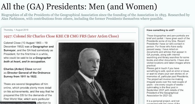
I have spent much of the last four days researching the 1920s and the history of the Geographical Association for the next phase in my major project around my GA Presidency: the creation of a biography of all the presidents since 1893, and associated events. I've also been contacting lots of former Presidents and finding out a whole range of stories and connections to Check out the project here. I'm currently in 1927, and the most recent President to be added was Charles Close, who was Director General of the Ordnance Survey.

Research informed work on Climate Change - thanks to Saffron O' Neill

Image
You'll have noticed a Climate Change trend appearing in recent posts on the blog perhaps, following my starting work as a UN Accredited Climate Change teacher which has meant a lot of behind the scenes work to develop some new support options which will be made available to all schools in time. This is a critical time for influencing public behaviours, and ensuring that students are aware of the realities of Climate Change, which is going to change the world they live in, and require certain changes in their lifestyle, purchasing, transport options and potentially far greater changes. I've been following up various leads to new Climate Change resources, which are different to the norm. Saffron O' Neill replied to one of my requests for help with some research she is doing on how  people view Climate Change, and how it is represented in the media. She developed some work about how people respond to climate change. The tweet I saw was this one... Paper just accep

Riceboy Sleeps

Image
Last Monday, I kickstarted my summer holiday with a trip to the Barbican to see the UK premiere of Riceboy Sleeps. A week or so earlier, the performance had been given its World Premiere at the Sydney Opera House. Watch a few of the tracks here... This was so beautiful.

Support Scott Warren

Image
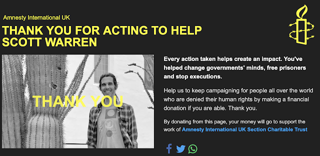
I blogged a few days ago about the organisation No More Deaths , which gives humanitarian aid to those attempting to cross the desert into the USA and leaves water for them to save lives. Geography Professor Scott Warren was working with the association when he was arrested, and faces trial. He faces ten years in jail. Amnesty International has set up a link where you can provide information and edit / send an e-mail to help campaign for Scott's release. Support a fellow Geography teacher, and the work of this organisation.

Dan Raven Ellison - "talking walking"

Image
Dan Raven Ellison interviewed as part of a podcast series. Delighted to announce our latest Talking Walking interviewee: Dan Raven-Ellison talking walking https://t.co/rFyWQR7Qx4 — Museum of Walking (@museumofwalking) July 18, 2019 It goes back to Mission:Explore and the Geography Collective and our work raising the public consciousness of geography. The podcast can be downloaded, as well as some notes , and Dan referencing the late Duncan Fuller and Doreen Massey, who we worked with, and the MisGuides. A good listen for the journey to work perhaps...

Climate Change and Landscape change

Image
Another Climate Change related post. Permafrost is thawing around the Arctic. This interactive website explores the impact of this on the landscape, and on the people who live within it. Excellent work by the Toronto Star. It includes a quote by Sheila Watt-Cloutier, an Inuit environmental, cultural and human rights advocate and author of the book ' The Right to be Cold ', which I have a copy of, and is excellent. "Our identity is strongly linked to the ice, cold and snow. Our right to hunt, our right to health, our right to educate our children, our right to safety and security … in fact, all of our human rights as Indigenous peoples would be minimised and destroyed by climate change.” Here's Sheila talking about this aspect of Inuit life.

Hit Factories

Image
This is part of my summer reading list. As I was reading the first chapter, I thought I might make a Spotify playlist, but it turns out that has already been done. More on this book to come as I get to it... 🎧Go on a musical journey through the industrial cities of British pop with @karlwhitney 's #HitFactories Spotify playlist, featuring New Order, Bowie, Portishead & Teenage Fanclub: https://t.co/WC97YFQ91M 📖HIT FACTORIES is out tomorrow in hardback and ebook pic.twitter.com/htKruOfW5O — W&N (@wnbooks) June 26, 2019

FlexClip

Image
I spent ten minutes today making a video for the coming weekend's open / celebration morning. This will involve lots of visitors to the Department, and we are going to set up lots of displays as well as putting out Year 7 and 8 projects and sharing some new resources we've had since last year. The video was made using Flex Clip, which is a very easy to use video making tool. It's also FREE of charge. A timeline along the bottom shows the scenes as they build up, and the film can be previewed. Make an account and the film is saved automatically as you work on it. Add videos or images from either your own library or a large library of stock scenes and videos. Music can also be added - there are some good choices of music to use - all free of charge as well. Export the video to different sizes right up to 1080p. I've then uploaded the video to VIMEO so that the quality is kept intact. Some features of the tool that I like. FlexClip is an all-in-one web tool

Mountain Man

Image
There are many books already on the groaning shelves of the GeoLibrary about mountains: from the book that propelled Robert MacFarlane into the public eye: 'Mountains of the Mind', to Joe Simpson's daring adventures on, and below Siula Grande in Peru. There are the Appalachians, as walked by Bill Bryson, and the peaks conquered by Mark Beaumont as he cycled the Americas. These books have been joined by a new one, which is set purely within the confines of England and Wales. It has been written by James Forrest, who is a fellow Ordnance Survey GetOutside Champion , and describes a challenge that James set himself to conquer all 446 mountains in England and Wales. They are known as the Nuttalls, and are defined as 'peaks above 2000 feet (609.6m) in height'. James set himself a time challenge as well: six months to reach the summits of each of the peaks, and during one of the wettest periods in recent years this was not going to be easy. He had to fit the t

Francis Pryor on the Fens

Image
Reading about the new Francis Pryor book on the Fens. I'm very much looking forward to reading this, and factoring it into some writing on the Fenland landscapes. As Francis writes: In the 20th century the historic medieval cores of towns like Kings Lynn, Wisbech and Spalding were severely damaged by development and insensitive road-building. The well thought-out railway network in the Fens was destroyed by Dr Beeching’s ‘rationalisation’ of the 1960s. Consequently many smaller market towns today boast empty high streets, poorly-attended markets and numerous charity shops. We are also beginning to appreciate the extent of irreversible change that the wholesale drainage of the 1850s and 1970s has caused. And with sea level rise a seemingly inexorable process… Need I say more? The floor of my study is about two metres above sea level; an average high tide would wet our bed, upstairs. And yet, people are still regularly granted planning permission by local authorities to build bun

Show your Stripes

Image
We have been using the warming stripes for some time in our department, and I also have a natty warming stripes tie. I shall be wearing it on Friday when we Show our Stripes It's time to #ShowYourStripes by visiting: https://t.co/xZmp3uP2OQ ! We have made warming stripes graphics available for virtually every country, and including US states and UK regions. These are free to use however you like! These are my #warmingstripes : England (1884-2018). pic.twitter.com/v5C6GD3koL — Ed Hawkins (@ed_hawkins) June 17, 2019 Ed Hawkins is behind the stripes. He has created a new website where you can download stripes for your own home region. We will all be wearing the Stripes on the 21st of June. Posters are up in the Geography Classroom. Stickers are printed for everyone to wear. Annual average temperatures for England from 1884-2018 using data from UK Met Office. Graphics and lead scientist: Ed Hawkins , National Centre for Atmospheric Science, University of Reading. Dat

Musical Urbanism

Image
This is an excellent resource for those looking at resources and ideas on the intersection between cities and music. You can follow the blog at Musical Urbanism , or the TWITTER FEED here. The creator of the blog is Leonard Nevarez  and he is also well worth following. For example, this post gives me a lot of joy... looking for recommendations of books/interviews with Rush that emphasize their background and early years in suburban Toronto pic.twitter.com/lWtiTAvPoI — Musical Urbanism (@MusicalUrbanism) June 14, 2019

Brick Lane - Food culture in the UK

Image
This film was made in 2018 for the Survey of London by Nurull Islam and Rehan Jamil.  It documents the changing South Asian restaurant trade in Whitechapel, and includes the restaurant located in this building. It's part of the Survey of London website. It documents the change in the area of Brick Lane from the Bengali restaurant trade to 'hipsters' who moved in, buying up the old premises. This film is based on a restaurant on Mark Street.   It's a lovely piece of work. It's an excellent little film, useful for GCSE - UK in 21st Century - food and culture, or perhaps Changing Places as well.

Places of Poetry - The Fens

Image
The Places of Poetry website has launched today. I mentioned it earlier in the year when I first heard about it. It is collecting poems which are written about places, which can then be pinned to an interactive map. Click the menu icon top right on the home page for all the details and to add your own poem. Read about the project on the OS blog here.  There is a link with the Ordnance Survey. The project has been developed by Paul Farley and Professor Andrew McRae, who says: “Poetry has been used across the centuries to reflect on places and their histories. We’re using modern technology to reinvigorate this model, and we hope that as many people as possible get involved. We are excited to see where people pin their poems, and what they say about the places that matter to them.” I went on this morning and added my own poem to the map. You can view and read it here, just outside of the city of Ely. My poem also has a link to the Ordnance Survey, as it describes the surve

Current listening - Outcrops

Image
Outcrops by Spaceship A review can be read here. Focussing on a series of sandstone outcrops above the West Yorkshire town of Todmorden, Outcrops is an exploration of the geological history of the Upper Calder Valley and Cliviger Gorge. Revitalising an enthusiasm for geology that saw Williamson complete an undergraduate degree in Earth Science in the 1990s, each track was created to invoke a particular phase of that history, namely the interbedded sandstones and siltstones of the Millstone Grit, the formation of the Yorkshire coal measures and finally the glaciation of the valley during the last ice age. The album was recorded in the field, in a series of small caves where Williamson created the pieces that make up the album whilst almost encased within the landscape he was describing. These recordings were then treated to minimal editing and post production in Williamson’s home studio at the base of the hills where the recordings were made. In this way the album becomes analogo

National Map Reading Week

Image
It's a pity that it's during the school holidays as we normally do a big push on this at school, and it's sometimes been later in the year. It's National Map Reading Week , so try to get out there this week with an OS Map and try the downloadable guides. Perhaps this is the week to do a trial of the OS Maps app - it's excellent...

Counter Mapping

I'm signed up to receive the newsletter from The Global Oneness project, and have just received one with information on an intriguing film explaining how some indigenous people 'map' their territories. It's embedded here: In this 10-minute film, we meet Jim Enote, a traditional Zuni farmer, elder, and director of the A:shiwi A:wan Museum and Heritage Center in Zuni, New Mexico. The film documents Enote’s work with Zuni artists to create maps that bring an indigenous voice and perspective back to the land. “Counter mapping” challenges the western notions of geography and the borders imposed on indigenous cultures.  In the film, Enote said that “Maps have done a lot to confuse things for people. More lands have been lost to native peoples probably through mapping than through physical conflict.” We discussed the positive and negative impacts of modern mapping and technology, the colonization of land and the re-naming of territories, as well as local natives and la

Humanities 20:20

Image
A new manifesto for Primary Humanities has been launched today. Visit the website, read the manifesto and sign it if you like what you see. Primary schools have a duty to equip children for the challenges of the 21st century. We believe that the primary school curriculum in England is failing to do this or to fulfil the legal requirement for a balanced and broadly-based curriculum. Literacy and numeracy dominate the curriculum while other vital aspects of learning are often ignored. This is wrong. We want young children to be literate and numerate, but much more than that. We affirm that every child is entitled to rich, stimulating and engaging learning experiences. We want children to have more opportunities to be creative and to build on their sense of curiosity. We would like to bring more joy and imagination back into the classroom. Its 20.5.19 and its 20.20! We are live! https://t.co/3ZVckCnjwW >View the Manifesto. >Sign Up! Join in! >Spread the word! #RT

A geographer as Poet Laureate

Image
Simon Armitage was announced today as the new Poet Laureate, replacing Carol Ann Duffy. I've been aware of Simon Armitage and his work for many years, going back to when I was doing my degree in Huddersfield, and he was living nearby in Marsden. He is the same age as me, the same age as Surtsey, about which he made an excellent radio programme - currently unavailable to listen to. He studied Geography at Portsmouth University, which makes him a geographer too, of course. Check out his poem Last Snowman , about Climate Change. I've read much of his poetry, and all of his non-fiction work. An early favourite (from 1999) was 'All Points North': a meditation on what it means to be from the North, and about the North... Also check out the recent books where he follows long distance footpaths, including the Pennine Way. Also check out his poem 'Poundland'  from a recent collection.

Free Hywel Roberts Webinar

Image
Hywel Roberts is running a webinar on the use of narratives in teaching, drawing on his work in this area with a number of other educators. It is described as a reverie. The link to the webinar is here. It's free, and having been fortunate to see Hywel present his ideas in person, I'll certainly be making every effort to listen in to this one.

Quarter of a million page views

Passed the 250 000 page view milestone this morning. Thanks for all the interest in this blog since I started writing it back in 2007. Not quite up to the level of the 5 million views of LivingGeography, but encouraging anyway....

A day in a favela

Image
A 36o degree Video... Watch this on your phone, or pan around... In Rio, one out of every five residents lives in a favela. More than one and a half million people. More than one and a half million stories. Step inside this 360 experience of a day in Favela and meet some truly inspiring people and view.

An exciting opportunity linked to the Better World Detectives

Image
For the last year or so I've been involved with the ongoing development of resources linked with the travel company TUI. These resources come under the banner of the Better World Detectives , which connects with TUI's own sustainability statement of Better Holidays, Better World. The resources introduce students at key stages 2, 3 and 4 to key ideas related to sustainable tourism, and are free to download.   They reflect TUI's work on promoting more sustainable and greener holidays. The Primary resources are based around the fictional resort of Sonrisa, which is based on Costa Rica. They introduce students to sustainable fishing, the impact of tourism on local corals, and the efforts to protect local turtle nesting sites. The Secondary resources are focussed on sustainable sourcing of food for hotels, carbon footprints, ocean plastics and the impacts of overtourism. These go into more depth, including a look at how tourism can impact on the health and well-being of re

Young Geographer of the Year 2019

Image
#GeographyTeacher ! Today we're launching this year’s Young Geographer of the Year Competition, which asks students ‘Where can geography take you?’ - We can't wait to see all of your entries #YGOTY https://t.co/RdZYgA8yR3 pic.twitter.com/BFb6mHAnYv — Royal Geographical Society (with IBG) (@RGS_IBG) April 5, 2019 There is also the Rex Walford award for trainee teachers to produce resources on the same theme. As always, we'll be working with our students to produce some entries for this competition. Find out all the details, and age categories here. Hopefully will pick up more details from the RGS-IBG stand at the GA Conference next week in Manchester.

Shipping containers

Image
Showed this very useful video earlier in the week, made by the Maersk Shipping Line. This goes well with the activity on p.58 and 59 of the Hodder Geography ' Progress in Geography ' textbook, which I use as part of my unit on Stuff. .. It links to the location of the OOCL Hong Kong  using the Marine Traffic website, following its route between China and Europe like a bus... Image: Alan Parkinson: shared under CC license

900 posts

Just up to 900 posts now... Thanks for reading....

The return of Carmen Sandiego

Image
Carmen Sandiego was the eponymous character in an early computer game, which was based around a sort of global treasure hunt / mystery. It was launched in 1985, and reissued in 1992, and spawned various sequels. Now Carmen Sandiego is back, and instead of ' Where on Earth ' she is.. this time it's ' Where on Google Earth ' is she? You'll probably see the game option pop up if you use Google Earth close to the time when this blog was posted... if it's been a while, then the option may have disappeared. Start up Google Earth on Chrome and give it a go... You'll even see a little Carmen Sandiego icon in the main navigation area...

Cultural Geography

Image
There are some useful ideas in the video here. The Department of Education suggests any decoding of the geographies around us: “should… start from the local place within which students live or study and at least one further contrasting place through which to develop the required knowledge and understanding. Study must involve moving out from the local place to encompass regional, national, international and global scales in order to understand the dynamics of place. (Note that a local place may be a locality, neighbourhood or small community, either urban or rural)”

Discover Iceland with Richard and Matt

Image
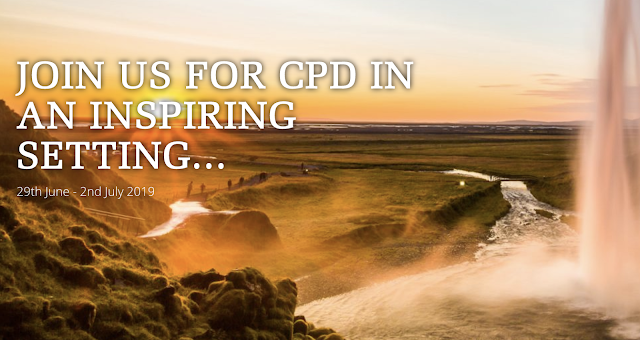
Discover the World are organising an exciting-sounding CPD event in Iceland in June which involves Richard Allaway and Matt Podbury. This is designed for those teaching (or preparing to teach) international qualifications. Day 1 - 29th June 2019 Arrive in Keflavik and head to the Hafnarfjordur area for your overnight stay. Day 2 – 30th June 2019 8.00 – 8.15 Welcome from Discover the World Education from our travel specialist, Beverley Cameron. 8.15 – 10.15 The Physical Geography of Iceland, lecture by Professor Chris Davies. 10.15 – 10.30 coffee break 10.30 – 12.30 workshops by Matt Podbury and Richard Allaway 12.30 – 20.00 Tour of Iceland’s iconic Golden Circle guided by Chris Davies including stops at Thingvellir, Geysir, Gullfoss and a few hidden gems. Overnight in Selfoss area Day 3 - 1st July 2019 Depart hotel at 8am for an exciting tour of Iceland including: Visit to the geothermal town of Hveragerdi View two of Iceland’s most remarkable waterfa

Dialects - where are you 'from'?

Image
This has been going the rounds for the last few days, and is an updated version of a previous quiz which aimed at pinpointing people's home area from the way they pronounced certain words, or used vernacular terms for particular things. For some reason, it was shared from the New York Times website. I was born in Rotherham, and so I had a childhood using words like snicket, spell and wagging it. It was successful in identifying Sheffield as the likely area. I have since lived in Norfolk for more than half my life, but not lost some aspects of my accent and natural vernacular vocabulary. The quiz was less successful pinpointing my son, with a vague diagnosis of the SE of England. How accurately does it locate you?

Using illustrations for teaching and learning about migrant experiences

Image
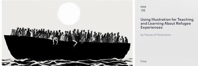
House of Illustration and Positive Negatives are delighted to invite educators to a very special Teachers’ Twilight Event to celebrate the launch of our brand new teaching resources for Key Stages 2, 3 and 4. These new resources use illustration techniques for teaching and learning about this important subject. Packed with both inspiration and practical guidance, these cross-curricular resources are completely free to download and ready to use in the classroom. House of Illustration will launch our KS2 resources, packed with guidance notes, a choice of activities, step-by-step instructions and a slideshow, while Positive Negatives launches their own resources for KS3 and KS4, built around comics and short animations. These complementary projects address the experiences of unaccompanied young asylum seekers, the dangerous journeys to Europe being undertaken by refugees and the lives of undocumented young people in the UK. We provide information and activities to explore citiz

An Englishman (and Geographer) in New York

Image
I'm heading for New York , for the first time, during the Easter break. I've got a few guide books from colleagues, and advice from people who've been before, and got a hotel booked. We'll be there for quite a few days, and will of course be hitting the usual places you would expect: Top of the Rock, Ground Zero, Staten Island ferry etc. There's some plans for architecture, film locations, walking the High Line, taking in a show and some psychogeographical wanderings. Does anyone have any suggestions for things that I definitely should not miss as a geographer? The Central Park erratics and rôche moutonnee are on the list of course, as well as the many urban highlights. Image by Ella Parkinson, edited using Prisma app.

London National Park City crowdfunder

Image
There has been a great deal of progress on Daniel Raven Ellison 's campaign for London to become a National Park City.  This will be launching in July, and Daniel has started a Crowdfunding campaign to ensure that as many Londoners as possible know about it. Why not support the project with a small donation.

Food Choices

Image
Food choices are important... Intensive or organic? To eat meat or not? Watch the film below, and read this accompanying piece from the Guardian which takes this a step further, and explores the importance of intensive farming and our potential food gap, which was flagged up by the World Economic Forum.