Delighted to say that I've been awarded one of just two of these awards handed out this year, given out by the Royal Geographical Society, to work on a collaboration jointly with Dr. Benjamin Hennig from the University of Oxford on a project related to the Census of 2011.
Ben is the genius who created the Worldmapper cartograms, and creates maps at Views of the World.
He is now working at one of the finest Geography departments in the world, and it is a real privilege to get the chance to work with him.
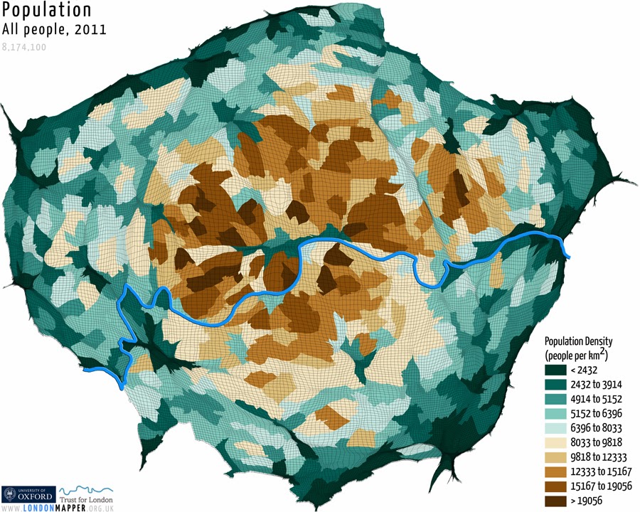
Our project is called LondonMapper: exploring a World city through Census Data
The Census 2011 produced billions of pieces of data, and by focussing on London past, present and future we will explore ideas related to London and its place in the world, and guide students on an exploration through the Census data and present them with some decisions that need to be made, which will shape London's future...
Our work will connect with, and expand on the nascent LondonMapper project.
Look out for more new maps like this one
Some more interesting London-based news coming in the next month or so too....

Comments